Map Setting
The Formatting Map-Setting Properties are as follows:
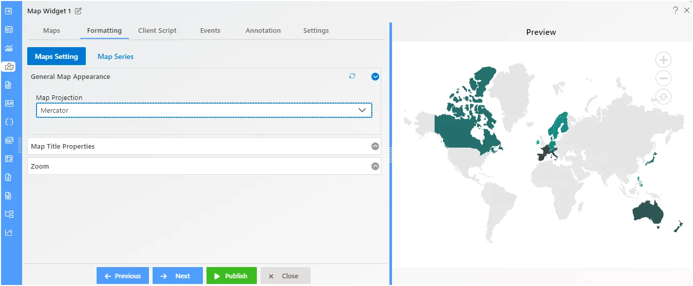
Map Setting - General Map Appearance
Overview: In General map appearance you can customize the default Projection and appearance of the MAP.To Change the Formatting Property of the Geo Map, you need working Datasets with country or state names.
Description: Follow the steps to perform the Map Appearance from below:
- Create a Geo Map with available Dataset.
- In Formatting Property click on Map Setting.
- In Map Setting click on General Map Appearance.
- Enter the Following details in General Map Appearance. Select the Map Projection: Mercator
- Fill above details in the edit box, As Shown in figure;
- Click on Publish button.
- Now, match your Geo Map with the below example, it should look like the figure below:
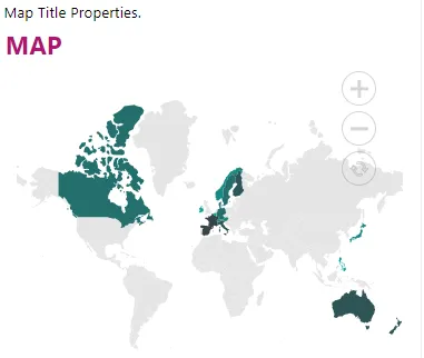
Map Setting - Map Title Properties
Overview: You can define and customize the Chart title using the title property of the Map. The Title property of Map is used to set the text for the title. You can align the title text content horizontally to the near, center, or far of the MAP using the alignment property of the title. To Change the Formatting Property of the Geo Map, you need working Datasets with country or state names.
Description: Follow the steps to perform the Map Title properties from below:
- In Maps Setting click on Map Title Properties.
- Enter the Following details in Map Title Properties:
- Map Title: MAP
- Font Size: 22
- Font Weight: Bolder
- Map Title Align: Left
- Color: #b01472
- Fill above details in the edit box.
- Click on Publish button.
- Now, match your Geo Map with the below example, it should look like the figure below:
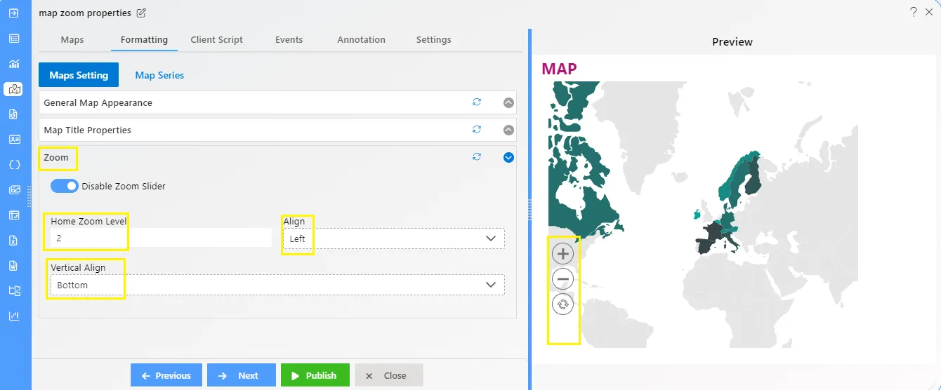
Map Setting - Zoom
Overview: The zooming feature enables you to zoom in and out of the map to show in-depth information. It is controlled by the Zoom property of the map. When the zoom level of the Map control is increased, the map is zoomed in. When the zoom level is decreased, then the map is zoomed out. We can set the alignment of the zoom. To Change the Formatting Property of the Geo Map, you need working Datasets with country or state names.
Description: In Maps Setting click on Zoom Property.
- Enter the Following details in Zoom Property:
- Toggle Enable zoom Slider
- Home Zoom Level: 2
- Align: Left
- Vertical Align: Bottom
- Fill above details in the edit box.
- Click on Publish button.
- Now, match your Geo Map with the below example, it should look like the figure below: